Graig Uchaf
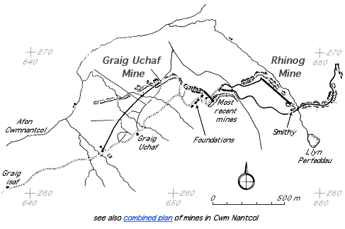
| Location | SH645266 (Area map showing location.) | ||||||||||||||||||||||||||||||||
|---|---|---|---|---|---|---|---|---|---|---|---|---|---|---|---|---|---|---|---|---|---|---|---|---|---|---|---|---|---|---|---|---|---|
| Parish | Llanbedr | ||||||||||||||||||||||||||||||||
| Owners | Merioneth Manganese Co. 1886–1887 Dyffryn Mining Co. Ltd 1889–1994 agent 1889–1893 H J Wright |
||||||||||||||||||||||||||||||||
| Worked | 1886–1892 | ||||||||||||||||||||||||||||||||
| Production and Employment |
|
||||||||||||||||||||||||||||||||
| Transport | Tracks, with built-up embankments in places, from both lower and upper parts of workings to loading bank at SH64542630. The loading bank may have been used for transfer from sled to cart: local memory refers to horses and carts being used to take out manganese ore [Gwyn 1998: app. 2: 148]. | ||||||||||||||||||||||||||||||||
| Remains | Shallow open workings SH64442646–SH65002688, mostly overgrown by woodland. Underground workings, some accessible SH64732672–SH64862680 (working at SH64832680 has two lengths of rails in situ). Tracks from mine to Graig Uchaf track. Substantial loading bank at SH64542630. (February 2007) | ||||||||||||||||||||||||||||||||
Some sources use the name Graig Uchaf to refer to Rhinog mine.
Richards [1991: 149] records a “tiny open pit” slate working at SH650268.
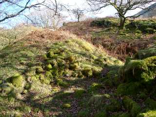 |
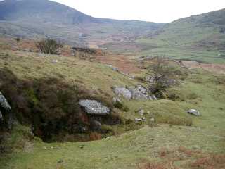
Surface workings Surface workings and tips overgrown by woodland at SH65002688. Considering the lack of definition of the features and the overgrowth it is considered that this is the older part of the workings. |
|
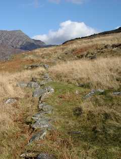 |
Dry-stone causeway Down [1980: 41] mentions a tramway from upper part of mine to the loading bank at SH64542630. Although this causeway exists on one part of this route it does not appear to be part of a continuous tramway formation. |
|
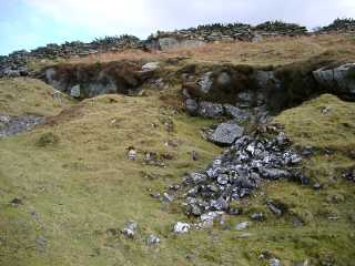 |
Tips and entrances to underground workings Some of the entrances appear to have been deliberately closed-up. |
|
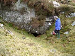 |
Entrance to underground workings The ground surface is considerably higher than the floor of the passage inside (as can be seen from the next photograph) and the entrance apears to have been deliberately walled-up with the current opening of relatively recent origin. |
|
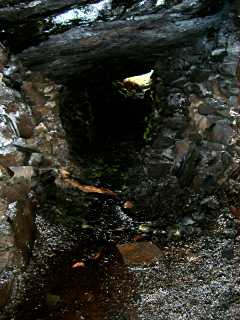 |
Underground workings Looking back to the entrance shown in the previous photograph. (The working face was behind the camera position.)
The walls either side of the passage are formed of stacked waste. The underground workings consist of the usual excavation along a relatively long face with waste stacked on the outer side of the working area forming a pssage parallel to the outcrop. |
|
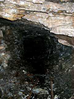 |
Underground workings Further on in the same workings. Again the passage walls are formed of stacked waste. In the foreground can be seen a pair of rails (displaced from their original positions) whilst behind them are another pair of rails apparently still in situ. Behind the camera position is another entrance, now completely blocked. |
|
 |
Walled-up waste tips Note the narrowness of the barrow-way between the tips (as indicated by the size of the notebook included for scale). |
|
 |
Entrances to undergound workings |
|
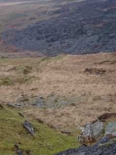 |
Surface workings Surface workings seen from near Rhinog mine barracks. The position of the boundry between Graig Uchaf and Rhinog workings is not known. |
|
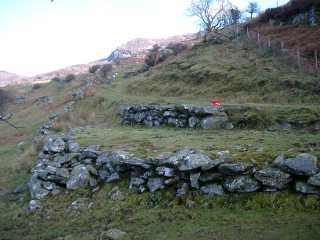 |
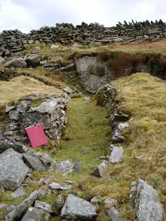
Loading Bank Loading bank at SH64542630 by track from Graig Uchaf farm and Rhinog mine. |
|
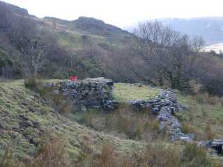 |
Loading Bank Another view of the loading bank. The track from the mine comes from behind and to the right of the camera position. |