Garn
| Alternative name | Panorama [Morrison 1975: 83] |
|---|---|
| Location | SH620163 (Area map showing location.) |
| Parish | Llanaber |
| Owners | |
| Production and Employment | |
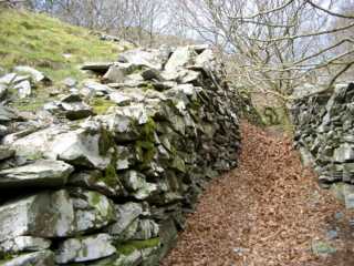
| Transport | The passage between the tip retaining wall (see photo below) and the enclosure wall may have been a sledge run. |
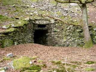
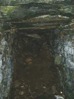
| Remains | Impressive built-up portal with wing walls to level though loose ground. Has run in close to the entrance due to failure of a roofing slab. There is a tip with a retaining wall to the left of the level. (March 2001) |
Recorded as a manganese mine [GAT SMR: 20583]. The location is in the Gamlan Formation [Allen & Jackson 1985a: 51] and there are no obvious signs of manganese mining on the ground. The location is the same as that given for the Panorama copper and gold mine [Morrison 1975: 83]
The entrance appears to be aligned with and is possibly associated with a near-by flooded shaft and small surface workings, which were possibly only trials. Again, there is no sign of manganese having been worked at these points.
The location is shown as “Level (Lead)” on the 1887 6" map [OS 1st edn: XXXVI] and as “Old Level (Lead)” on the 1900 25" map [OS 2nd edn: XXXVI.6]. Wilkinson [1993] refers to this location as Garn East No 2 with the mineral worked as “unknown”. (Wilkinson also mentions Garn East No 1, again with the mineral worked as “unknown”, at SH619163 which appears to be the location of the flooded shaft referred to above.)