Ffridd Tyddyn Du
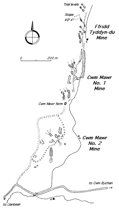
| Location | SH637328 (Area map showing location.) | ||||||||||||||||||||||||||||||||||||||||
|---|---|---|---|---|---|---|---|---|---|---|---|---|---|---|---|---|---|---|---|---|---|---|---|---|---|---|---|---|---|---|---|---|---|---|---|---|---|---|---|---|---|
| Parish | Llanfair | ||||||||||||||||||||||||||||||||||||||||
| Geology | see Cwm Mawr No. 1 | ||||||||||||||||||||||||||||||||||||||||
| Owners |
|
||||||||||||||||||||||||||||||||||||||||
| Production and Employment |
|
||||||||||||||||||||||||||||||||||||||||
| Transport | Short internal tramway. Roads connecting adit levels and loading banks. | ||||||||||||||||||||||||||||||||||||||||
| Remains | Underground workings accessed by adits. Two adits have loading banks. Well-built road connecting adits [Down 1980: 34]. Area of worked-over ground through which the river runs below the surface. Remains of small building aprox 2 m x 2 m internal dimensions with domestic hearth at SH63603258. (March 2005) | ||||||||||||||||||||||||||||||||||||||||
A short (~ 150 m) internal tramway is shown on the 1901 6" map [OS 2nd edn: XIX SE] at SH636324.
Described as “idle” in 1923 [Dewey & Dines 1923: 65].
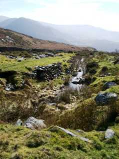 |
Workings
Worked-over ground at the south end of the sett near the boundary with Cwm Mawr 1. Just off the left of the picture the river emerges from beneath the surface of the worked-over ground. |
|
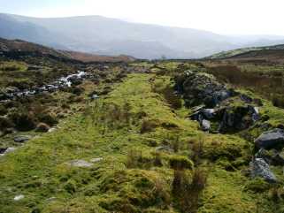 |
Workings
A further view of the south end of the sett. This is to the north of the picture above. |
|
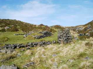 |
Loading bank and pillar
The picture shows a loading bank or ore storage or dressing platform. The purpose of the pillar on the other side of the track is unknown. It might have supported rails from behind the platform so that a side-tipping wagon could have tipped into a cart but it seems rather lightly constructed for that. |