Dolbebin
| Alternative name | Dolbebyn [GAT SMR: 20616]
Dolybebin [Down 1980: 32] |
| Location | SH604278 (Area map showing location.) |
| Parish | Llanbedr |
| Owners |
|
| Worked | –1887, 1918, 1923 |
| Production and Employment |
|
(tons) | Manpower
underground surface |
| 1918 | | 4 | |
| 1920 | | 1 | |
| 1921 | | suspended |
| 1922 | | suspended 1920 |
|
| Transport | Presumed cartage to Llanbedr via track to Cwm Nantcol road above Salem chapel. |
| Remains | Mostly underground workings (some enterable) on left bank of Afon Artro. A track on an embankment of built-up waste runs down the bank alongside the workings. The highest underground working has rubbish dumped in it. The river bank is post-working woodland. (September 2005) |
The 1887 abandonment plan (surveyed by Edward Stables) entitled ‘Plan of Portions of the Lletty Walter and Dolybebbin estates’ exists [GAS DAO: 2125]. The enlarged section (below right) is based on that plan.
The plan and section right are incorrect in that the alignment of the Dolbebin mine workings and track that descend to the river is approximately N.N.E. - S.S.W. rather than as shown currently. A corrected plan will be shown in due course.
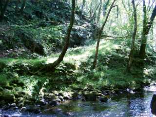 | |
Track and workings
Looking across Afon Arto to the bottom of the track.
The two areas of shadow on the far side of the track conceal entrances to levels.
|
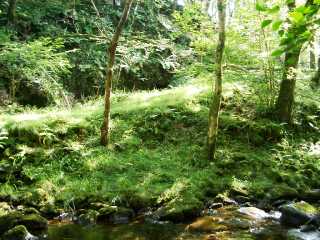 | |
Track and workings
Another view of the area shown in the above photograph to show the slope of the track.
|
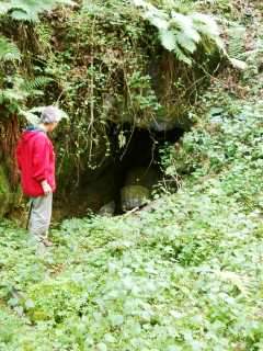 | |
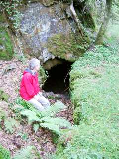
Level near river
Possibly the No. 1 level referred to on the abandonment plan. The level is blocked with walled-up waste immediately inside the entrance.
|
 | |
Level
Level immediately above that shown in the photograph above. The level runs though walled-up waste across the strike of the bed. It is possible to emerge from this level up a slope through another entrance a short distance up the track.
The rock face above the entrance shows jointing at right angles to the bedding. (The bedding dips downwards to the left.)
|
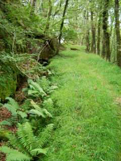 | |
Track and workings
Looking south up the track that runs alongside the workings. Much of the track is on an embankment of stacked waste which forms the wall of the trench to the left and the steep bank to the river on the right.
The workings originate in the trench and dip downwards to the left. The left wall of the trench is mostly walled-up with occasional entrances into the underground workings, one of which can just be seen (partly obscured by vegetation) at the end of the trench.
|